Jakarta transport map
You can find on this page the Jakarta transport map to print and to download in PDF. The Jakarta transportation map presents the transports network and transport zones of the transit of Jakarta in Java - Indonesia.
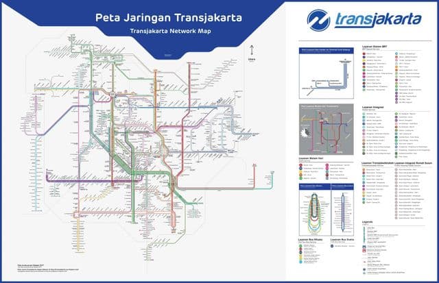
Jakarta transports map
The Jakarta transport map shows all means of transportation in Jakarta. This transports map of Jakarta will allow you to move easily with public transport of Jakarta in Java - Indonesia. The Jakarta transportation map is downloadable in PDF, printable and free.
Jakarta is the capital city of Indonesia . It is an urban metropolis with over 8 million inhabitants. It is predicted that over four million residents of the surrounding Jabodetabekarea commute in and out of the city each working day. As a growing megacity, transportation issues have significantly arisen and it has been estimated that in 2020, without a major transportation breakthrough, traffic jams will overwhelm the city and cost the city 65 billion rupiah. Since 1980, more than 25 general and special subject studies have been conducted related to Mass Rapid Transit in Jakarta as its shown in Jakarta transports map. One of the major reasons for this lengthy process lies in the outbreak of the economic crisis in 1997. Before the crisis, a Build-Operate-Transfer (BOT) scheme was considered for the MRT, calling for private sector involvement. After the crisis though, BOT implementation proved infeasible as a privately-funded venture, and the MRT Project was proposed again as a government-funded scheme.